 Contact →
The map is
the territory.
Terrain affects every decision.
You need terrain intelligence.
- Sense
- Reconstruct
- Map
- Reason
- Navigate
Matterhorn, Zermatt · Elevation: AWS Terrain Tiles / Mapzen
Imagery © swisstopo; cross-border imagery © Airbus Defence and Space · © OpenStreetMap contributors
01 · Built for agents
AI-first GIS.
Mappa is a terrain workstation with a copilot built in. Ask it to plan a route, find vantage points or check what a sensor can see — it works through the same terrain tools an analyst would, step by step, and shows its work.
Mission planning and terrain analysis run in the cloud or at the edge — on a laptop, a vehicle or a ground station, with no connection required. The same capabilities are open to your own agents through MCP.
- —Mission planning and terrain analysis
- —Cloud or edge, online or offline
- —Open agent interface (MCP)
 ZermattMission plan
02 · Georeferencing
Every camera knows where it's looking.
Mappa registers what a camera sees to the map and the terrain — its position, heading and zoom — so every pixel has a true location on the ground.
Fixed and pan-tilt cameras map their own coverage and blind spots, hand off targets with real coordinates, and notice when they've been moved.
- —Scene registration to map and terrain
- —Camera position, heading and zoom
- —Coverage and blind-spot maps
03 · Resilient navigation
Navigation that doesn't need GPS.
When satellite navigation is jammed, spoofed or simply unavailable, Mappa's visual positioning lets drones and robots fix their position by recognising the terrain and landmarks around them.
It matches what the camera sees against maps built from satellite and aerial imagery and elevation — no prior flight over the area required.
- —Visual positioning in GNSS-denied areas
- —Matched against satellite and aerial maps
- —Air and ground platforms
04 · Reconstruction pipeline
From raw pixels to a measured world.
A high-throughput pipeline that turns raw imagery — from satellites, aircraft, drones or cameras on the ground — into accurate maps, 3D surface models and photorealistic scenes, anywhere on the planet, without a survey team.
It scales from a single site to whole regions, and every layer is labelled as measured or modelled, so you always know what you can rely on.
- —Satellite, aerial and ground imagery
- —Surface models, buildings, GIS layers
- —Scalable and high-throughput
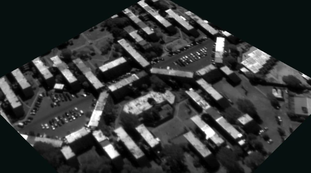
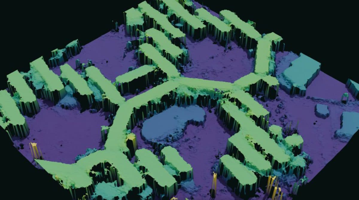
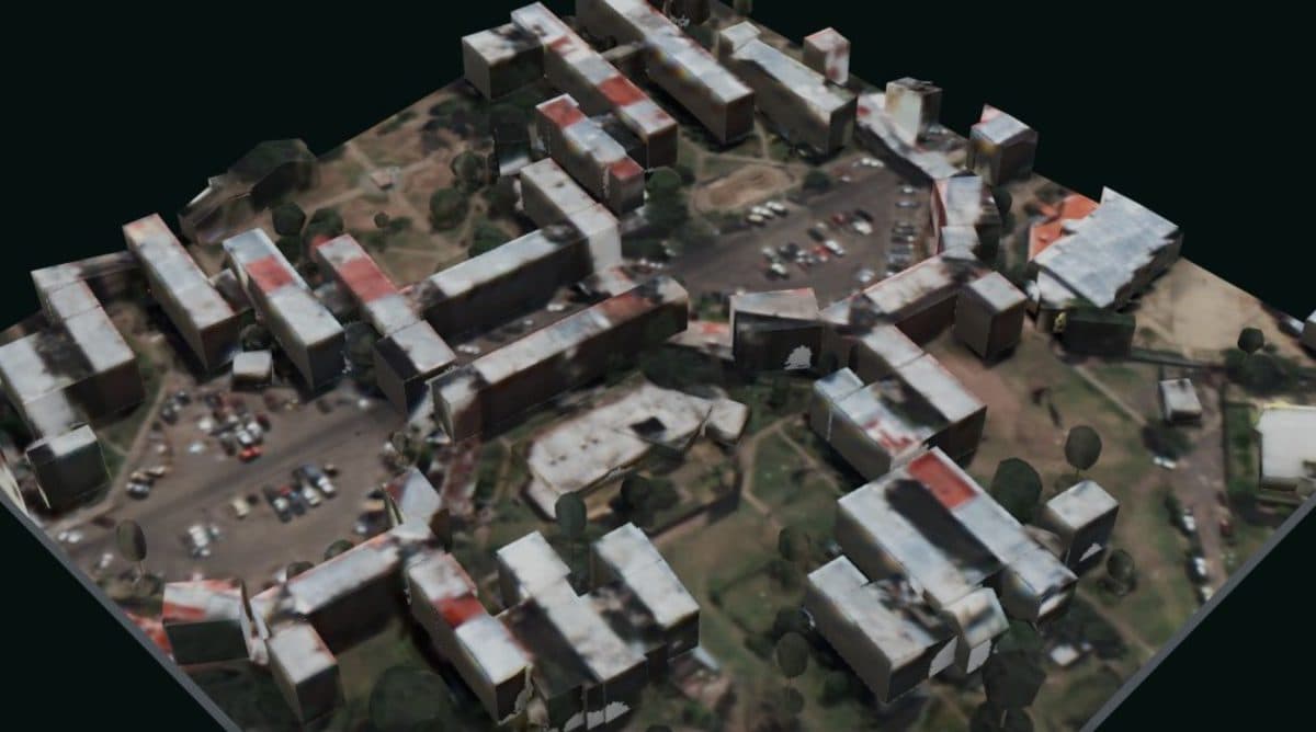
Imagery: IARPA MVS3DM / JHU APL, courtesy DigitalGlobe (Maxar)
05 · Industries
For everyone whose decisions depend on the ground.
Drones, robotics & autonomy
Positioning and situational understanding for machines that move — in the air and on the ground, with or without GPS.
Defense & national security
Terrain analysis at machine speed, sensor data anchored to the map, and navigation that keeps working when GNSS doesn't.
Border & critical-site security
Cameras and sensors that know exactly where they're looking, with coverage and blind spots mapped across every perimeter.
Energy, utilities & telecom
Siting, line-of-sight and corridor planning for grids, pipelines and networks — before anyone is sent into the field.
Mapping & digital twins
Measured 3D terrain and buildings from existing imagery, for planning, simulation and autonomy testing — without a survey flight.
Emergency response & civil protection
Fast terrain answers for the people on the ground: how to get there, what they'll see, and what's at risk.
06 · Contact
Ground your AI in the real world.
Work with us
Building drones, robots, camera networks or AI agents that act in the physical world? We work closely with early partners to put terrain intelligence into their systems.
contact@mappalabs.com →Join us
We're a small team of researchers and engineers working on 3D vision, geospatial AI and robotics. If teaching machines to understand the ground sounds like your problem, we'd like to hear from you.
Get in touch → The map is the territory. · © 2026 Mappa Labs